Weekend Walk Programme Spring/Summer 2024
Sunday 7th April – Strathmore. Walk Start Point: Alyth Den. Landranger map 53 Grid Ref. 235487.
We will leave Alyth Den and take up the Cateran trail from Alyth towards Bridge of Cally before turning off to climb Hill of Alyth. Part of this initial stage is described in stages 1 and 2 of the walk at https://www.walkhighlands.co.uk/perthshire/alyth-blairgowrie.shtml We then descend northwest towards Little Bamff before turning East to Ardormie to take up the Cateran trail back to Alyth. This part of the walk is described in stages 6 and 7 of https://www.walkhighlands.co.uk/perthshire/glenisla-alyth.shtml A useful leaflet with map about the Cateran trail is at http://www.pkc.gov.uk/media/11013/Cateran-Trail-Leaflet/pdf/Cateran_Trail_Leaflet.pdf?m=636102123828170000 8 mile walk with 425 metres of ascent.
------------------------------------------------------------------------------------------------------------------------------------
Saturday 20th April – Glen Clova. Walk Start Point: Clova Car Park. Landranger map 44 Grid Ref. 326730.
We have two walks planned for today.
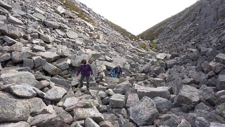
Walk 1. The longer walk today goes from the Clova car park to Loch Brandy and up the steep climb to The Snub. We will then go on to Green Hilland Rough Craig before going to Adielinn and following paths back to the car park. 8 mile walk with 700 metres of ascent.
Walk 2. This is a shorter truncated version of walk 1 stopping at The Snub and retracing the outward route back to the car park. 5 mile walk with 600 metres of ascent. A useful guide to walks in Glen Clova is at https://cairngorms.co.uk/wp-content/uploads/2021/06/Glen-Clova-Paths-1.pdf
------------------------------------------------------------------------------------------------------------------------------------
Sunday 5th May – Strathardle. Walk Start Point: Kirkmichael. Landranger map 53 Grid Ref. 079600
This interesting circular walk takes us from Kirkmichael past Dalnagairn and Whitefield Castle to follow a tracck to the summit of Cnoc Meadhon, northeast of Kirkmichael. We then continue to pick up a track to the ruin at Menachmore and past Balvarran and Milton before returning to the car park. 10 mile walk with 460 metres of ascent
------------------------------------------------------------------------------------------------------------------------------------
Saturday 18th May – Glen Esk. Walk Start Point: Invermark. Landranger map 44 Grid Ref. 447804.
We have two walks planned for today.
Walk 1 – A circular walk from Invermark past Invermark castle and along the north shore of Loch Lee. The walk then continues past the scenic Falls of Unich and Falls of Dammff before climbing Craig Damff and Hunt Hill and descending to a track back to Invermark. The walk is on tracks and paths, some of which are rough and open ground on the stretch to Craig Damff and Hunt Hill. 12 mile walk with 820 metres of ascent.
Walk 2 – A shorter version of walk 1 to the Falls of Unich and returning to Invermark. 9 mile walk with 360 metres of ascent.
------------------------------------------------------------------------------------------------------------------------------------
Sunday 2nd June – Glenshee. Walk Start Point: Car Park at south side of ford. Landranger map 52 Grid Ref. 988340.
This circular walk takes us from the car park round the side of Drum Tick and on to the summit of Craig Gibbon and the obelisk on its summit. We then carry on round the side of Moine Foiaich before rejoining the outward route and returning to the car park. More details of the walk can be found at https://www.thecourier.co.uk/fp/lifestyle/outdoors/1671331/walk-this-way-craig-gibbon-a-popular-hillock-among-jumble-of-hills-accessed-from-little-glenshee/
8 mile walk with 500 metres of ascent.
------------------------------------------------------------------------------------------------------------------------------------
Saturday 15th June – Little Glenshee. Walk Start Point: Auchallater. Landranger map 43 Grid Ref. 156883.
This is an enjoyable circular walk from Auchallater past Sron Dubh and Sron nan Gabhar to the summit of Creag nan Gabhar. We complete the circuit by returning by way of Bealach Buidhe. More details of the walk can be found at https://www.walkhighlands.co.uk/cairngorms/creag-nan-gabhar.shtml
9 mile walk with 560 metres of ascent.
------------------------------------------------------------------------------------------------------------------------------------
Sunday 30th June – Glen Esk. Walk Start Point: Edzell picnic point by North Esk. Landranger map 44 Grid Ref. 577690.
This circular walk begins with some road walking before turning off to track at Margie. It then continues to Hill of Corathro and the Crannel before descending to Meikle Tullo and returning by way of Dalbog and Edzell castle. 9 mile walk with 440 metres of ascent.
If you are interested in joining the club or coming on a trial walk please look at our How To Join page or e-mail us at: [email protected]